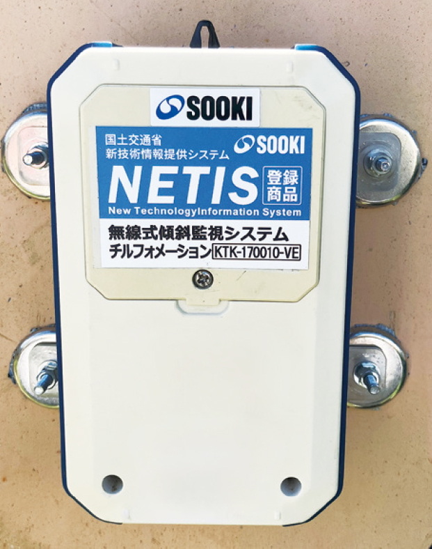
Wireless Inclination Monitoring System
Tilformation
KTK-170010-VE
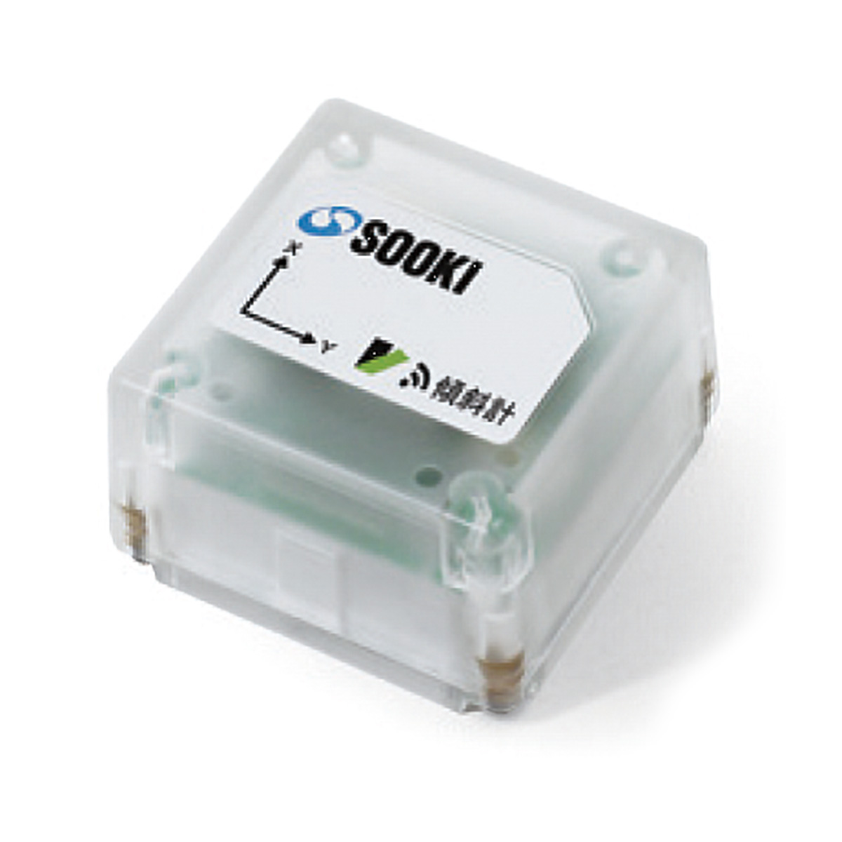
This system is a wireless inclinometer-based tilt monitoring system that shifts from the conventional high-precision, high-functionality and high-cost model to a simple, user-friendly, and affordable solution. In the event of an anomaly, it issues real-time alerts via email notifications and a rotating warning light. Measured tilt data is stored on a cloud server and can be checked at any time from a PC, tablet, or smartphone.
Overview Diagram
-
![Riverbank Monitoring Measurement]()
Riverbank Monitoring Measurement
-
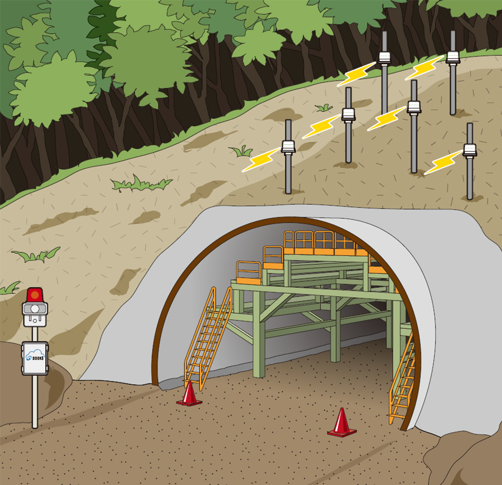
![Tunnel Portal Slope Monitoring]()
Tunnel Portal Slope Monitoring
-
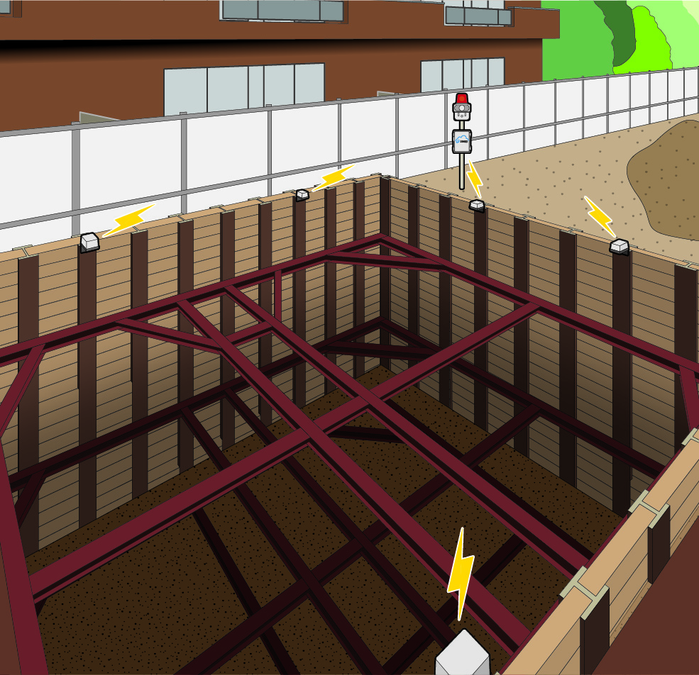
![Excavation Support Monitoring]()
Excavation Support Monitoring
-
![Landslide Monitoring]()
Landslide Monitoring


System Configuration
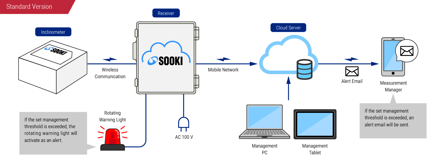
Standard Version
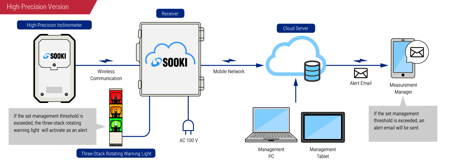
High-Precision Version
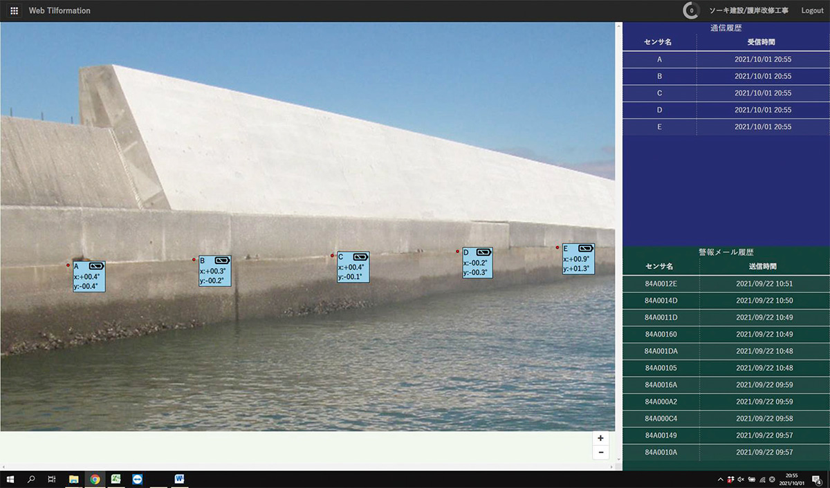
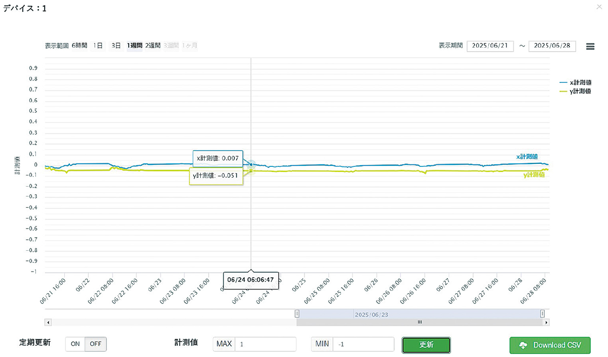
Management Software
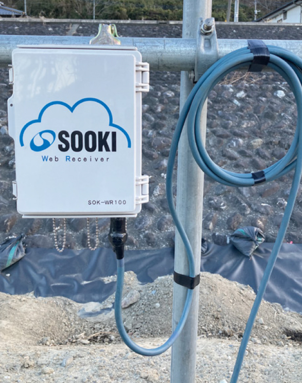
Construction Photography
Specifications
| High-Precision Version | Standard Version | |
|---|---|---|
| Measurement Range | ± 10 ° | ± 15 ° |
| Repeatability | 0.001 ° | 0.15 ° |
| Resolution | 0.0002 ° | 0.01 ° |
| Data Transmission Interval | 1s to any desired interval | 1, 10 s / 1, 5, 15, 30 min / 1, 3, 6, 12, 24 h |
| Display Unit | °, mm, ' , % | ° , mm , ' |
| Wireless Communication Range | Line-of-Sight Approx. 1 km | Line-of-Sight Approx. 100 m |
| Power Supply | 2 × AA battery | 3 × AAA battery |
| Battery Life | Approx. 1 year at 10-min intervals | Approx. 3 months at 10-min intervals |
| Dustproof / Waterproof | IP67 | IPX4 |
| Operating Temperature | -10℃ to 55 ℃ | -5 ℃ to 55 ℃ |
| Weight | Approx. 260 g | Approx. 200 g |
| Dimensions | 88 (W)×33 (D)×146 (H) mm | 67 (W)×67 (D)×41 (H) mm |